
In Canada, multiple hikers found themselves stranded on a steep, perilous cliff edge, lured by a non-existent trail listed on Google Maps. The North Shore Rescue (NSR), a volunteer rescue team based in Vancouver, recently conducted their third rescue in the area, emphasizing the absence of actual trails and the danger posed by the rugged terrain.
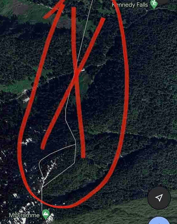
The latest rescue involved deploying a helicopter and a rope team to reach the stranded hiker on Mount Fromme in the Kennedy Falls region. NSR emphasized the absence of trails and the area’s steep, cliff-ridden landscape, which they had previously marked with warning signage due to its history of fatalities.
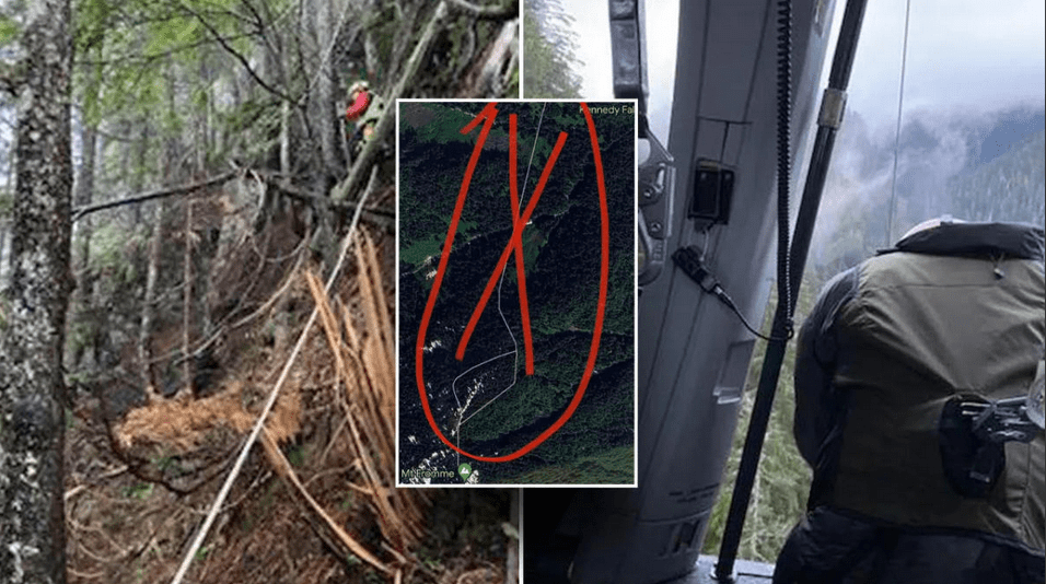
“To be clear, the area in question has no trails and is very steep with many cliff bands throughout. In the preceding weeks, NSR has actually placed signage in the area warning of this,” NSR said in a Facebook post. “The area is clearly dangerous, as it was the sight of a previous fatality.”
They’ve urged hikers to avoid relying on urban street map apps for wilderness navigation, suggesting specialized outdoor apps like CalTopo or Gaia. Additionally, they stressed the importance of carrying a charged external battery, as navigation apps can quickly drain phone power. Their ultimate recommendation: the trusty combination of a paper map and compass.
“We always recommend the good old fashioned paper map and compass,” NSR said.
Despite NSR’s efforts to have the non-existent trail removed from Google Maps, their initial attempts to contact the platform had gone unanswered. However, following their public statement, the trail was eventually removed from Google Maps.
Google responded, confirming the removal of the misleading trail and highlighting their diverse sources for map updates, including third-party information and community feedback.
“We use a variety of sources to update Google Maps, including third party information, imagery and feedback from our community.”
The incidents underline the potential risks of relying solely on digital navigation in remote areas, emphasizing the need for hikers to equip themselves with appropriate tools and reliable information. NSR’s efforts to alert hikers to the dangers of inaccurate digital maps, coupled with the subsequent action taken by Google, serve as a cautionary tale about the limitations of technology in wilderness navigation.

, a volunteer rescue team based in Vancouver, recently conducted their third rescue in the area, emphasizing the absence of actual trails and the danger posed by the rugged […]&media=https://wonderfulengineering.com/wp-content/uploads/2023/11/ezgif.com-resize-2023-11-11T051411.490.jpg)