
What would you do if you found a Google Earth image of Lake Harriet in Minneapolis that shows a passenger plane submerged in the water? Yes, totally freak out. That’s exactly what happened once this was spotted (yes, actually happened) and eventually led to an investigation.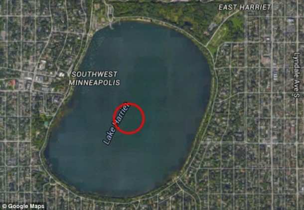
This supposed picture of the twin-engine aircraft scared the crap out of the officials who are in charge of Minneapolis parks since there was no information regarding any plane crash and thus began the investigation.
Eventually, the investigation concluded that the picture was merely a glitch in the Google Earth imaging. It was not an actual stumbled upon wreck of an airplane. Google technicians, who were brought in on the problem, were able to explain what had really happened.
Susan Cadrecha, a spokeswoman for Google Maps said, “In short: each satellite image you see on the map is actually a compilation of several images. Fast-moving objects like planes often show up in only one of the many images we use for a given area. When this happens, faint remnants of the fast-moving object can sometimes be seen.”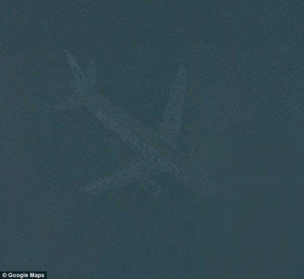
A similar image was also located nearby, at Lake Nokomis. Despite the fact that both of these lakes are about 5 miles away from the Minneapolis-St. Paul International Airport. A total of 400,000 planes land and take off annually from this airport. Nokomis and Harriet are in fact under a flight path thus making it more plausible that Google image could have captured a plane in flight over the lake.

 and eventually led to an investigation. This supposed picture of the twin-engine aircraft scared the […]&media=https://wonderfulengineering.com/wp-content/uploads/2016/02/A-Mystery-Plane-Was-Spotted-In-The-Bottom-Of-A-Minneapolis-Lake-On-Google-Earth.jpg)