
Necessity is the mother of invention. A technical mind is always looking for solutions to cater for existing issues. Similar research followed an experience faced by Sam Madden, a professor at MIT’s Department of Electrical Engineering and Computer Science.

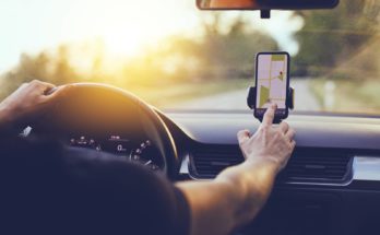
“While visiting Qatar, we’ve had experiences where our Uber driver can’t figure out how to get where he’s going, because the map is so off, If navigation apps don’t have the right information, for things such as lane merging, this could be frustrating or worse.”
Google Maps have indeed proven to be a reliable and efficient source of providing location information to users. But the data collection method is pretty exhausting, sending vehicles around all the corners to capture images of all dimensions. The technological advancements have made this app a must need for all. Finding a new route or reaching a previously unknown destination, have become undemanding than ever before. But does the app, keep a track of updated architectures?
Furthermore, the process is quite costly and can only be afforded by tech-giants. So, what was Madden’s approach?
Partnering with Qatar’s Computing and Research Institute, a team from MIT proposed bringing Artificial Intelligence, Machine Learning, and Satellite Imagery into practice for an improved version of GPS navigation. So, what’s the additional ingredient added with the effort?
Referred to as RoadTagger. The new software was introduced that has been equipped with neural networks. The good part is that it can help you see behind buildings, obstructions, and barriers. You can have a view of lanes or get to know the nature of traffic as well.
Peeking into the complex algorithms that have simplified human life, RoadTagger uses a Convolutional Neural Network (CNN) and Graph Neural Network (GNN). Both of the tools belong to the family of machine learning algorithms, which means that a limited set of data can be processed for further predictions. The entire activity involves minimum human interference.
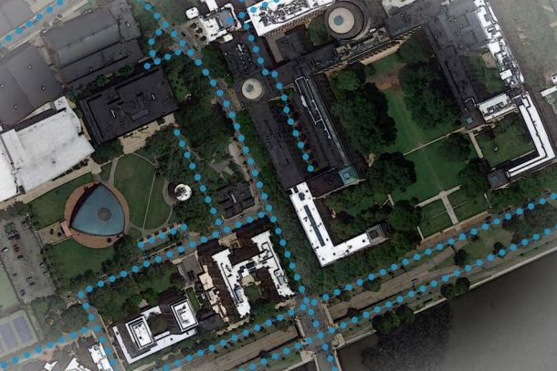
The procedure followed starts with feeding satellite images to CNN. Then GNN plays its part by forming ‘tiles’, 20-meter sections of the roadway. Data is extracted out of these tiles and detailed features are highlighted and learned. If a certain tile becomes invisible due to the presence of a building or an obstruction, the other tiles are studied to predict the nature of that respective tile.
Experimenting with the newly developed tool, 20 U.S cities were case studied. The results were 77 percent accurate for predicting lane numbers while 93 percent satisfactory for suggesting the road type. Discussing future plans for the software, the team said that it will incorporate improved features like parking predictions and bike lanes in Road Tagger.
Quoting the credit owners, “Our goal is to automate the process of generating high-quality digital maps, so they can be available in any country.”
