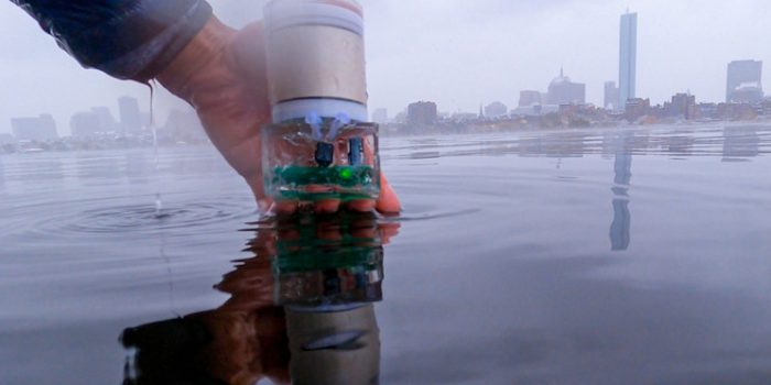
MIT developed an underwater navigation system that utilizes sound in place of batteries.
Our planet ‘Earth’ is three portions of water and one portion of land, and the water part is still inaccessible. Amazingly, space is better explored than the ocean floors around in the world. Scientists thought if space is explored to extreme limits, why aren’t the water bottoms explored in the same manner.
Scientists were of the view that it’s difficult to keep a long-lasting GPS underwater. However, it is in action for ages on the earth’s surface, stratosphere, and even beyond.
This urged the MIT team to come up with an underwater navigation system. The underwater system uses sound to function instead of batteries. The scientists behind the project have termed it as Underwater Backscatter Localization (UBL). The new system utilizes a two-way pattern instead of the batteries for moving around, increasing, and easing ocean exploration.
The research was presented in a paper at the ‘Association of Computing Machinery’s’ and became a hot topic in network workshops.
Water and GPS
Radio waves upon entering water become scattered and ineffective, which makes the GPS useless. This is where Sonar comes into play and is used widely under the water surface. However, this way of utilizing acoustics is a far more energy-intensive method.
To address this high energy consumption, researchers at MIT have developed UBL (Underwater Backscatter Localization). The novel system works on the minimum energy and is much effective for use in smaller devices.
The team used piezoelectric materials, as they can generate an electric charge under the conditions of mechanical stress. It works well even when it is subjected to sound waves.
The new technology uses piezoelectric sensors as backscatter and selectively reflects sound waves from the environment. And this helps in producing power.
A receiver then takes up the sound waves as a binary pattern. One of them stands for reflected sound waves and none of them for unreflected ones.
The UBL system utilizes a binary signal to carry insight, which is then used for creating a location fix. It simply calculates the duration in which a sound wave reflects off the sensor and comes back to the observation unit.
The team has shown how tricky this system could get. Shallow waters are a perfect example of its complexity, where reflecting signals off the ocean’s floor creates a difficult pattern.
To tackle this, the researchers switched to frequency hopping. Those of you who don’t know what it is are signals of changing frequencies sent across in patterns and returns at varying times.
It utilizes timing and the phase data allowed for specified location fixes.
As of now, the team is equipped with a proof-of-concept UBL system that is capable of going up to distances of 20 inches (50 cm). Their next steps contain increasing the range, and for the most, developing a navigation system that can map out ocean floors for autonomous vehicles.


