
Maps and their statistics have the capability of holding a tonne of information in a very small set of space. Have you wondered how many countries follow the left-hand drive and how many the reverse? What are the busiest air routes and numerous other useful and useless sets of information that makes you feel superior? Well here are 40 maps that will teach you more about the world than you may have ever known before:
1. Availability of Google Street View

2. Countries that use the British System of Units (Apparently even Britain itself doesn’t use them)

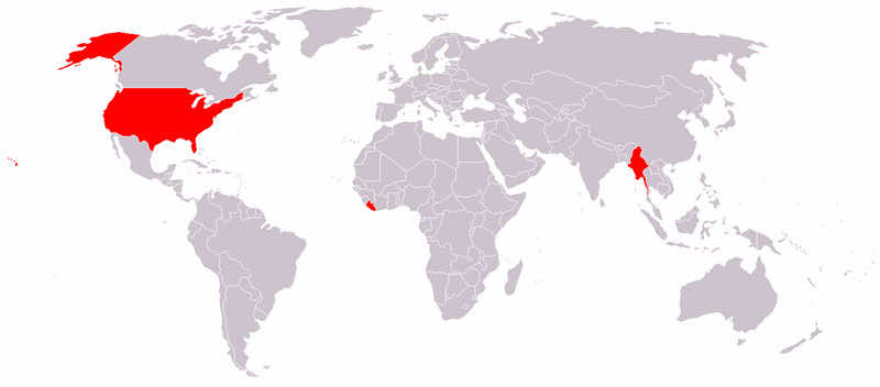
3. Countries Britain has never attacked

4. Pangea (Ancient singular land mass) with modern day boundaries

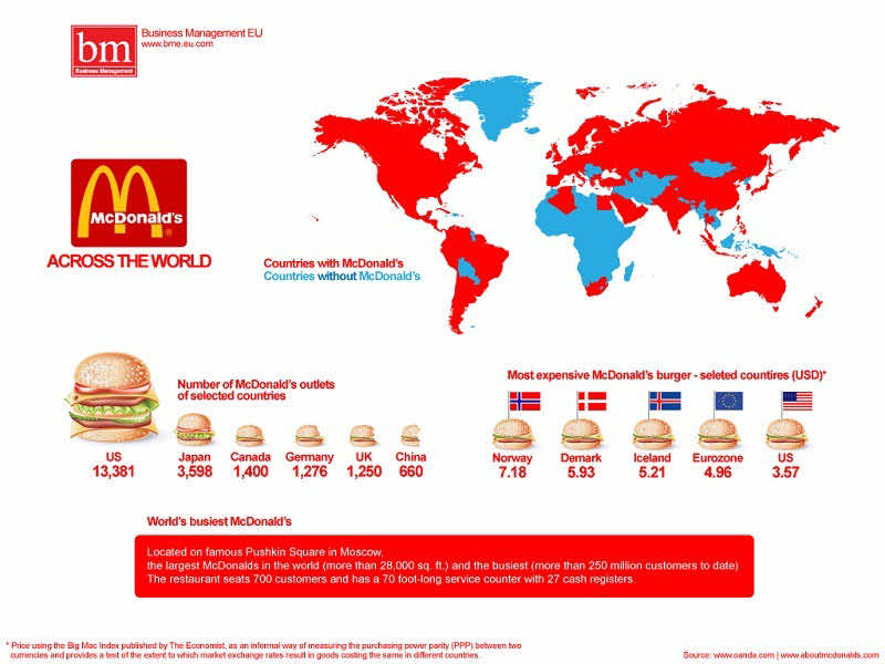
5. McDonald’s Stats

6. Paid Maternal Leave Offered. Only USA and a few others don’t!

7. Most common Surnames in Europe

8. Driving Orientation across the World!

9. Different Time Zones followed in Antarctica

10. Internet Usage in the World

11. Busiest Air Routes

12. More People in this circle than outside

13. Flags of nations

14. Consumption of Pure Alcohol

15. Map of Alcohol Beverage Consumption

16. Map of all rivers in America.

17. Highest Paid Public Employees in States

18. Earthquakes and their Intensity.

19. 28,000 rubber duckies were found at all these places after they fell off a cargo ship

20. Bribe Zones of the World

21. Vegetation of the planet.

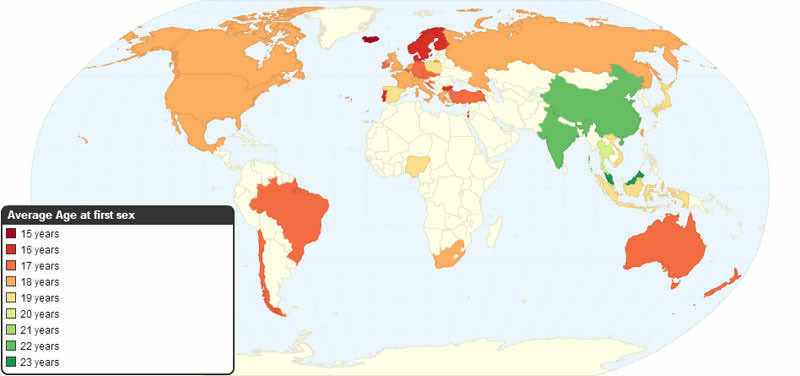
22. First Sexual experience Age

23. If the world had a population density of these cities, how much area they would cover?

24. Researchers Per Million; A measure of higher education

25. Major Oil Routes Across the World (This has changed with the discovery of Shale)

26. The 7,000 Tributaries of Mississippi River

27. Writing Systems Prevalent in the World

28. Coffee consumption around the world

29. The Economic Center of the World Through the Ages- Moving towards the East again

30. World Divided into 7 Regions with 1 Billion Population Each

31. Population density by latitude and Longitude.

32. United States if Placed on Moon

33. Frequency of Lightning Strikes

34. Water Risk to Populations.

35. Areas under Danger from Piracy

36. Ludacris’ Hoes

37. Area of Australia having population

38. Longest uninterrupted Straight Route (Karachi, Pakistan-Russian Kamchatka)

39. Literal meaning of European countries in Chinese

40. World Map Upside-Down


Love how according to the map there are absolutely no bribery in the USA at all yet there is in almost every other country on the planet. I don’t even think I’d believe it if there was just less!
I would have a world map of countries using the NTSC, PAL and SECAM television broadcasting systems.
Driving map is wrongly attributed. Please correct!
India is a right hand drive and US is left hand drive.
Street View is available in East Malaysia so that map is wrong.
The world upside down map looks like a duck is f@#*ing a chicken.
The rest of the maps are amazing. Puts a new perspective on things.
Take all the maps of just the USA out and leave all the world maps.
Now that would be wonderful.
Some great maps here, apart from one….
No. 2. “Apparently even Britain itself doesn’t use them”
The British use Imperial and Metric side by side in numerous things – pints used for beer, cider and bitter, gallons still in use for petrol alongside litres, road transport and speed is measured in miles (mph), inches and feet are still commonly used for height, weights of products are labelled with both on most food items, yards is the most common measurement when talking about playing fields in sports and acres in commercial properties and stones and ounces are regularly used to weigh a person.
So this is pretty much wrong and an urban myth.
Well you shouldn’t be proud of using miles, I’m from the USA and I wish we didn’t. Simply makes sense to go with the standard of meters etc. What’s up with 12 inches in one foot?? (I know you never said you were proud of it but assuming so XD)
Excellent teaching for adults as well as kids. Maps can boost education in many countries. We need more maps like yours. And with easy access. English is oK. Do not abuse in adds though.
All this maps are really amazing.I shocked when i saw 16th map which show all the rivers of U.S.A.
very nice work
Hi my name is Ghulam Murtaza. I love you <3