
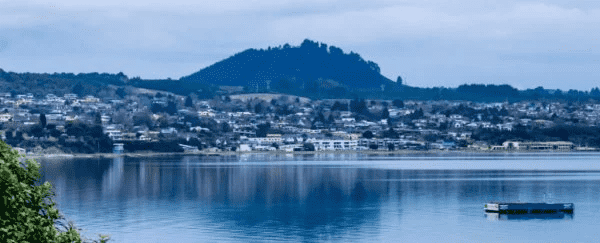
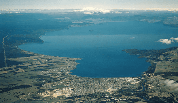
The magnificent beauty of Lake Taupo and the stillness prevailing in the surroundings cannot make us believe that it has been a victim of massive geological unrest for a long time. It is the largest freshwater lake in Australasia and is situated on the northern island of New Zealand. However, recent research conducted by New Zealand’s journal of geology and geophysics revealed some interesting details about the volcanic eruptions that happened at this peaceful lake. “Prehistoric caldera” is a word used for the lake’s waters that means “cauldron” or “boiling pot”. This phenomenon came into existence some 25,400 years ago and is known as the “Oruanui eruption”.
During this eruption, magma was emancipated, which caused the Earth’s surface to bend down while the topography of the region transformed into a caldera. If we look back at history, then the Taupo volcano has shown its vigor 25 times in the last 12,000 years. The authors of this paper described these recent eruptions as “one of the Earth’s most explosive eruptions in historic times”. Moreover, the researchers have compiled 42 years of data and assessed it at 22 different sites in the vicinity of the lake to detect the presence of any signs of this super volcano.
Unfortunately, the results reveal that this supervolcano is still echoing from the depths of the lake as per the shreds of evidence collected. According to the lead author and Victoria University of Wellington seismologist Finn Illsley-Kemp, “In 1979 [researchers] began a novel surveying technique which uses the lake surface to detect small changes, with four surveys made every year since.” To that end, the technique is viable as it involves the use of a gauge system in measuring the “vertical displacements” of lakes. Similarly, to assess the reliability of the data collected through this system, the factor of variability was introduced to take several measurements at each data point. In this way, the efficacy of this system could be assessed.
Coupled with that, a backup system of gauge was also deployed at each data point, so just in case if one system fails or shows some errors due to the disturbance in the lake, the backup system can then compensate on its account. Manual readings were taken from the inception of this technology from the gauges deployed at six stations. However, between 1982 and 1983, the system underwent an increase in units with the addition of a further eight stations, and the system started showing results with effectiveness. The rising and falling of the tides and the earthquakes were smoothly detected by these gauges installed at different stations.
As per Illsley-Kemp, “Within the lake, near Horomatangi Reefs, the volcano has caused 160 mm [16 cm or 6.3 inches] of uplift, whereas north of the lake, the tectonic faults have caused 140 mm [5.5 inches] of subsidence. However, Taup? will most likely erupt at some stage over the next few thousand years – and so it’s important that we monitor and understand these unrest periods so that we can quickly identify any signs which might indicate a forthcoming eruption. “
