
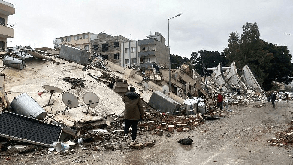
The 7.8 magnitude earthquake that struck Turkey and northwestern Syria on February 6 killed approximately 46,000 people and left millions homeless, making it the greatest disaster in modern history.
We frequently hear promises about the ability of AI to fix the world’s problems. In this case, AI may improve disaster response after the earthquake that devastated Turkey and Syria.
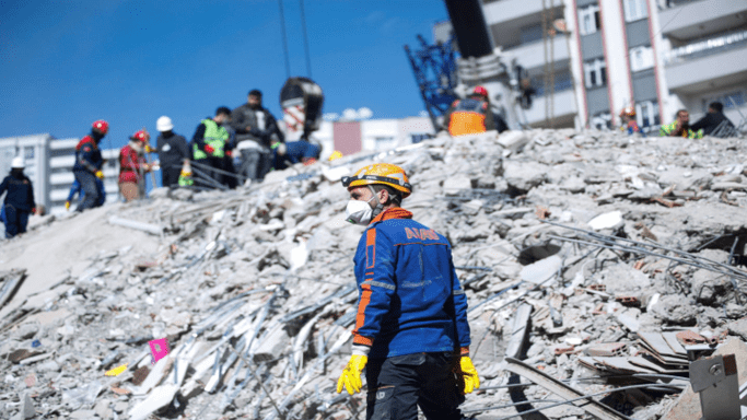
The United States Department of Defense is employing a visual computing artificial intelligence system to assist current disaster response activities, and it appears to be effective. The xView2 AI-based technology is currently in its early stages of deployment. In Turkey, this visual computing project has already aided in disaster logistics and on-the-ground rescue missions.
In 2019, the Pentagon’s Defense Innovation Unit and Carnegie Mellon University’s Software Engineering Institute sponsored and created xView2, an open-source project. It uses machine-learning algorithms in conjunction with satellite imagery from other suppliers to identify and analyze building and infrastructure damage in the disaster area far faster than current approaches.
According to Ritwik Gupta, the Defense Innovation Unit’s principal AI scientist and a researcher at Berkeley, the program can directly help first responders and recovery experts get an assessment that can aid in finding survivors and helping coordinate reconstruction efforts over time.
Over the last five years, the California National Guard and the Australian Geospatial-Intelligence Organisation have used xView2 to respond to wildfires and, more recently, during recovery operations following flooding in Nepal, where it assisted in identifying damage caused by subsequent landslides.
Gupta claims that xView2 was used by at least two different ground teams of search and rescue personnel from the UN’s International Search and Rescue Advisory Group in Adiyaman, Turkey, devastated by the earthquake and where residents were frustrated by the delayed arrival of search and rescue.
Furthermore, xView2 has been used elsewhere in the disaster zone and was able to successfully help workers on the ground “find areas that were damaged that they were unaware of,” he says, noting that the platform was used in response to the earthquake by Turkey’s Disaster and Emergency Management Presidency, the World Bank, the International Federation of the Red Cross, and the United Nations World Food Program.
“If we can save one life, that’s a good use of the technology,” Gupta said.
The algorithms use “semantic segmentation,” a technique related to object recognition that evaluates each pixel of an image and its relationship to neighboring pixels to make conclusions.
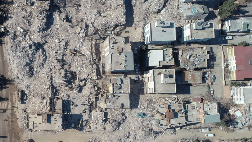
According to Atishay Abbhi, a World Bank disaster risk management specialist, this kind of assessment used to take weeks but now takes hours or minutes.
This is an improvement over more typical disaster assessment methods, which rely on eyewitness reports and phone calls to pinpoint where help is required immediately.
xView2, on the other hand, can generate a shared map of the affected area in minutes, allowing organizations to coordinate and prioritize responses, saving time and lives.
