
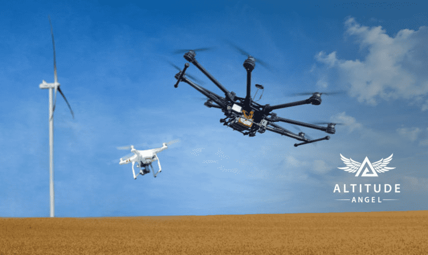
As drone technology is thriving with every passing day, the authorities have finally stepped up to develop the world’s longest highway, which would serve as a major pathway for drones to fly smoothly. This 165-mile (265 km) passage has been approved by the UK government to expand this other aspect of aviation. This huge project is being done under the supervision of one of the most renowned companies in the UK known as “Altitude Angel”. Through the efforts of this company, the proposal for this project, named “Skyway,” has also been accepted by “UK Business Secretary Kwasi Kwarteng at the Farnborough International Air show on Monday.”
The new highway will stretch all across England and will cover the main locations such as Oxford, Cambridge, and Milton Keynes. However, the town of Reading will make linkages with all these major areas listed above. The most important thing to note is that the aim behind the development of this project is to make the drones “survey infrastructures such as roads and ports”. With that being said, the drones will primarily be deployed in these areas along this highway to examine and analyze the attention to detail of the infrastructure to aid the managers.
As per the UK government, “The Skyway highway will be used initially to enable drones to quickly and efficiently survey infrastructure. This will reduce the need for transport system closures and make the delivery of goods more efficient. ” However, it should be noted that the project will be completed within a span of two years, as reported by the BBC. Along with this, this Skyway project is worth US$14 million and is looking forward to other projects similar to this one in the coming months. Some of them include the establishment of the Royal Mail’s 50 routes for drone delivery and the need to deliver the “world’s first chemotherapy drugs” by drones, which will be supervised by the National Health Service.
Coupled with this, there is a need to expand this current network of drone surveillance areas on the highway to a number of other routes, including the extension of airspace to “Southampton on the south coast and Ipswich on the east coast.” It should be noted that the Skyway project will implement the “detect and avoid” technology introduced by Altitude Angel in their “Arrow Drone Zone” project back in 2020 in order to avoid mid-air collisions between drones and carry out the operations in an efficient manner.

 passage has been approved by the UK government to expand this other aspect of aviation. This huge project […]&media=https://wonderfulengineering.com/wp-content/uploads/2022/07/ezgif-5-b57d8bde20.jpg)