Back in 2014, the Malaysian Airlines MH370 took off from the Kuala Lumpur International Airport, destined to land at Beijing Capital International Airport in China but disappeared while flying over the Indian Ocean. The disappearance became one of the biggest mysteries that remained unsolved to this day but new satellite images, taken fifteen days after the crash claim to have found the location of MH370.
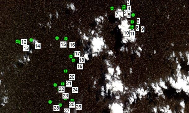
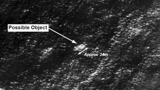
The aircraft disappeared on March 8, 2014, and the Pleiades 1A satellite captured four images on March 23, 2014. The Australian Transport Safety Bureau requested Geoscience Australia for assistance in analyzing these images and Geoscience Australia determined the images to “contain at least 70 identifiable objects.” They also said that 12 of these objects are “probably man made,” and another 28 could “possibly be man made.”

Australia’s Commonwealth Scientific and Industrial Research Organization (CSIRO) also released its third drift report, and they also hope to pave a way to finding the MH370 through these images. The report reads.
“Taking drift model uncertainty into account, we have found that the objects identified in most of the images can be associated with a single location within the previously identified region suggested by other lines of evidence. Furthermore, we think it is possible to identify a most-likely location of the aircraft, with unprecedented precision and certainty.”
Before anyone jumps to reaches conclusion, the ATSB Chief Commissioner Greg Hood clarified, “The image resolution is not high enough to be certain whether the objects originated from MH370 or are other objects that might be found floating in oceans around the world. Clearly, we must be cautious. These objects have not been definitely identified as MH370 debris.”

Geoscience Australia is hopeful to improve the analysis by comparing the images with additional images from the same satellite in similar sea state, but Dr. David Griffin of CSIRO declares these images to be very crucial and says, “If we find MH370, which we all hope to do. It will be thanks to all this satellite data, particularly the altimetry data.”
The search for the MH370 has been going on all these three years using all available resources including satellite data and radar tracking. So far nothing has proven useful, and the entire incident has become the greatest mystery of aviation history where even the finest of communication systems aboard the Boeing 777 could not help locate the plane. The communication systems were cut early into the flight, and the pilot did not communicate with the air traffic controllers.
Soon after, the plane’s transponder abruptly stopped transmitting the height and location information. Authorities later determined a 120,000 sq km (46,000 square miles) search zone along the Seventh Arc, where the plane could have potentially run out of fuel.
Whatever the situation may be, the families of the passengers aboard the unfortunate plane look forward to finding at least the remains of their loved ones.


Does this mean it was not in the Bermuda Triangle as another of your posts claim? (The Mystery of the Bermuda Triangle has finally been solved)