
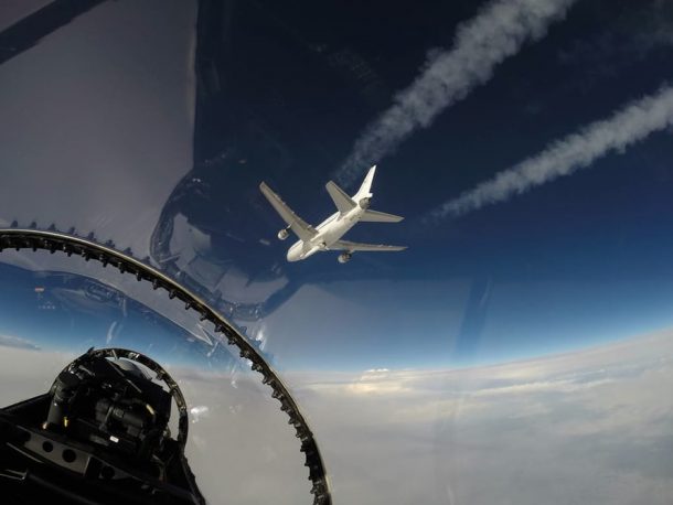
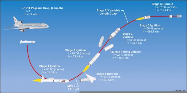
NASA just announced the launch of a new class of hurricane monitoring microsatellites, which interestingly enough, were released sideways. A Pegasus XL rocket was dropped today at 8:37 am EST Dec. 15 from a modified Orbital ATK L-1011 Stargazer aircraft over the Atlantic Ocean off the east coast of Florida from an altitude of 39,000 ft (11.900 m). The drop was the part of NASA’s Cyclone Global Navigation Satellite System (CYGNSS) mission.
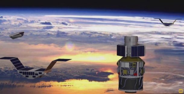
The rocket entailed three-stage booster, which fired its engines to soar into the orbit along with the eight microsatellites carried by it to monitor hurricanes using a new generation of remote sensors.
After the engines had fired, the rocket took only 13 minutes to reach the orbit and deploy the first couple of the total eight CYGNSS microsatellites. The next two followed after 30 seconds, and the sequence continued until all of them were successfully dispatched. According to NASA, all eight satellites were released by 8:52 am EST while contact was confirmed with the entire constellation by 4:12 pm EST.
While the launch was delayed for two days due to problems with the hydraulic release mechanism, it went off without a hitch under good weather. The Stargazer launched from Cape Canaveral Air Force Station in Florida and was dropped at 126 mi, 204 km east-northeast of Daytona Beach.
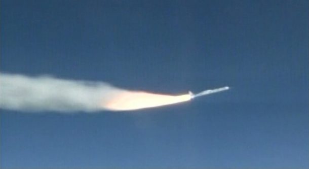
The CYGNSS launch was the 43rd successful flight for Pegasus, launching a record 94 satellites since its inauguration on April 5, 1990. The Orbital ATK system has been designed to operate from anywhere on Earth, while it uses an air drop from 40,000 ft (12,000 m) to increase possible payloads while cutting down on operating costs.
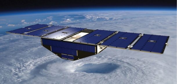
The eight small satellites sent into the orbit were developed by the University of Michigan and are designed to monitor hurricanes for long periods of time to speculate about their intensity and arrival more accurately. The satellites will perform this using direct and reflected GPS signals allowing precise fixing of the satellites’ positions along with being able to measure ocean surface roughness and wind speed.
The first set of data from the CYGNSS mission is expected to be received next week. Below is the video of the launch of the Pegasus XL CYGNSS mission.
