
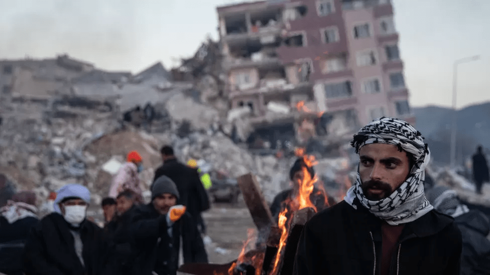
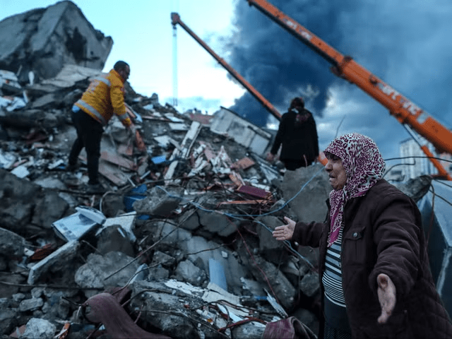
NASA Earth Observatory satellite photos illustrate the extent of devastation in Turkey and Syria after huge earthquakes killed over 20,000 people and displaced millions.
On February 6, magnitude 7.8 and 7.5 earthquakes rocked southern Turkey and western Syria. According to Eric Fielding, a geophysicist at NASA’s Jet Propulsion Laboratory, the “very large and powerful earthquakes” caused damage similar to the 1906 earthquake that “destroyed San Francisco.
“The earthquakes erupted all the way up to the surface across a long series of fault segments,” according to the report “Fielding explained.
It is estimated that thousands of buildings have collapsed. Rescue efforts have been begun but have been hampered by on-the-ground factors such as frigid weather and infrastructure concerns. So far, over 20,000 people have died, tens of thousands have been injured, and five million have been evacuated from their homes.
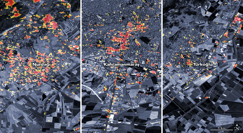
The NASA Earth Observatory published satellite footage of the damage to three Turkish cities. Dark red pixels indicate places where buildings, residences, and infrastructure are “expected to have serious damage” and “orange and yellow areas are partly or partially damaged.”
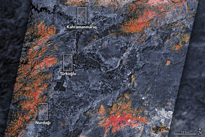
According to the observatory, each pixel represents a 30-meter region, roughly the size of a baseball infield. When zoomed in, smaller pockets of damage across the country are visible.
Fielding issued a warning that “seasonal variations” would result in certain errors. “Some of the areas marked as damaged in vegetated areas may not have been damaged, and some areas showing no damage in vegetated areas may be damaged,” he said.
Using the map, the Earth Science Applied Sciences Program’s disasters program team is working with the United States State Department, the California Seismic Safety Commission, Miyamoto Global Disaster Relief, and the World Bank.
To “assess the needs of stakeholders in the region and provide scientific expertise to support risk assessment and recovery activities,” the team is also collaborating with the U.S. Agency for International Development, according to a news release from NASA.
“We’re monitoring this event closely,” said Shanna McClain, the program manager. “In addition to mapping damage to the extent possible from satellites, we’re using satellites to track increased landslide risks, power outages, and weather that could pose challenges to response efforts.”
