
Japan has recently unveiled that they are developing a seafaring satellite-based surveillance system. It will utilize artificial intelligence (AI) and sophisticated satellite technologies to detect foreign ships operating near its territory. Through AI, the system can significantly chase down any suspicious vessels roaming under its waters.
Under the 2020 fiscal budget, the government has funded an initial 450 million yen (US$4.1 million to the project. In addition, various technology companies are also encouraged to present their proposals regarding the system.
For Tokyo, it is challenging to keep track of the vessels entering its vast ocean territories illegally, said an analyst.
“Japan’s resources are badly overstretched because it has such a huge amount of water to cover,” said Garren Mulloy, a professor of international relations at Daito Bunka University.
Being the eighth largest globally, Japan’s exclusive economic zone (EEZ) covers about 1.47 million square kilometres of the Pacific. Its ocean territories are over 11 times the land area of the country.
“If they attempted to cover that much open ocean with patrol ships, aircraft, or even satellites or drones, it would be incredibly difficult and not a very efficient use of resources,” he told This Week in Asia.
“But advances in AI in recent years mean that they are now able to scan many thousands of square kilometres of the ocean by picking up anomalies,” Mulloy said.

Such variances could involve vessels operating beyond Japan’s EEZ. It might also include ships that suddenly change their route or switch off their transponders to hide their whereabouts.
The new Japanese monitoring system will be deployed in 2024. It will utilize the huge amounts of data collected from satellites to verify the speed and direction of foreign vessels. Any questionable activity will be taken into consideration by the coast guard.
“This is cutting-edge stuff because AI is not usually used in this way and has only really been a useful resource for the last 15 years or so,” said Mulloy. “Something like this would have been invaluable back in the Cold War as the US tried to track Soviet submarines in the North Atlantic or the Pacific, but there was simply not enough computing power available at the time and no AI.”
According to Mulloy, the major area of interest is Okinawa Prefecture’s islands that China signifies as the Diaoyu archipelago, but Japan calls it Senkakus.
The AI-based surveillance system will be utilized to monitor North Korean and other vessels carrying goods that are banned under UN sanctions on Pyongyang. According to Mulloy, “Tokyo wants to be front-and-centre in the international effort against sanctions-busting vessels”.
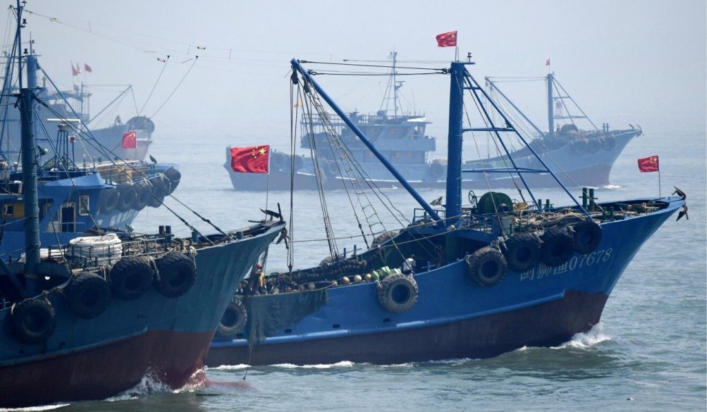
In addition, the technology will also oppose the illegal operations by foreign fishing ships. An increasing number of North Korean and Chinese boats have been identified on the Yamato Bank, a fishing ground in Japan’s EEZ.
As a result, Tokyo has issued exclusion orders to 80 Chinese fishing vessels illicitly operating in Japanese territory in the first four months of the year, mounting to be 138 orders annually, as issued last year.

 and sophisticated satellite technologies to detect foreign ships operating near its territory. Through AI, the system can significantly chase down any suspicious vessels roaming under its waters. Under the 2020 fiscal budget, the government has funded […]&media=https://wonderfulengineering.com/wp-content/uploads/2021/08/b7e40ac6-6f54-11eb-ba58-f8f0a43119e3_image_hires_102810.jpg)