
From the beautiful St. Bernard Pass in Italy to Scotland’s amazing North Coast 500, there’s nothing quite like going on a great road trip.
At least 13 million miles (21 million kilometers) of roads cover the whole world which range from big highways and motorways to countryside drives.
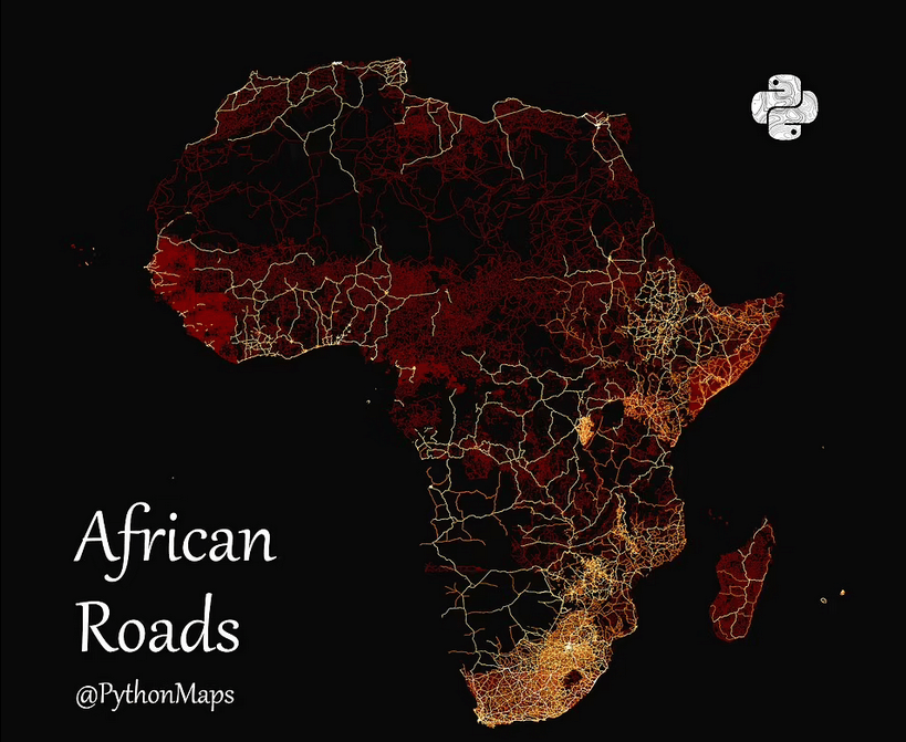
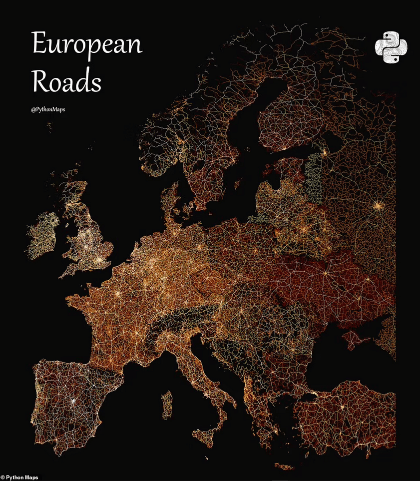
To help you see how much land these roads take up, Adam Symington from PythonMaps made a fantastic map for Visual Capitalist. It shows the roads of the world, divided by continent.
Surprisingly, the map shows that over 14 percent of the roads are in the US, while 1.24 percent are in Britain.
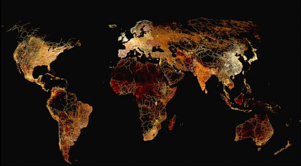
To make the map, Mr. Symington used the Global Roads Inventory Project. It collects information from governments, research groups, non-profit organizations, and projects that get contributions from people.
The roads were put into four groups and given colors. The big roads with multiple lanes are white on the map, and the paved, busy secondary roads are yellow. The map uses red for the smaller residential roads, whether they are paved or not.
‘This classification allowed for examining relationships between road infrastructure, development, wealth, and population distribution,’ Visual Capitalist explained.
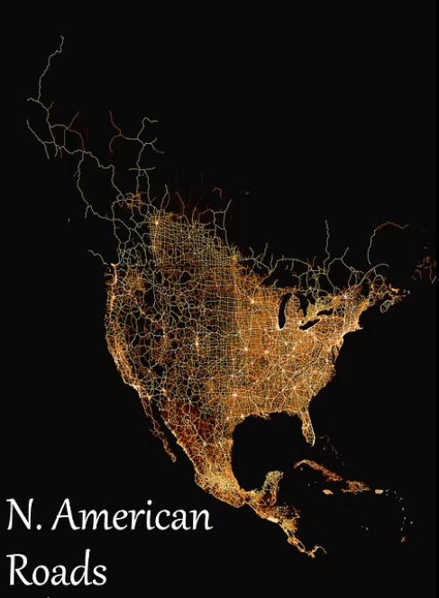
These maps give us variety of information when studied upon closely. One of the most interesting things that we can see from the map is that out of the 13 million miles (21 million kilometers) of roads in the world, 1.86 million miles (3 million kilometers) are in the US.
That’s almost twice as many as China (one million miles/1.7 million kilometers) and three times as many as India (600,000 miles/one million kilometers)—which are the two most populated countries.
At the other end, the small Pacific Island country of Palau has the smallest road network, measuring only 11 miles (18 kilometers) in length.
‘However, many of countries have even smaller networks, with Norfolk Island being the smallest in the dataset at 10km [6 miles],’ Visual Capitalist added.
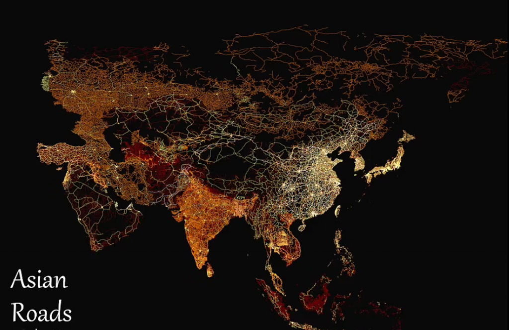
But when we look at the different types of roads, China without a doubt has the biggest roads which is followed by the US and Mexico.
These differences show up on the map, where North America looks white and yellow because of its many highways and main and secondary roads. Meanwhile, Mexico appears mostly red, since its roads are mostly smaller residential and local roads.
‘Something similar occurs in Europe, where old Cold War divisions play out in white, yellow, and red,’ Visual Capitalist added.
‘France, Germany, Italy, and the UK glow hot in a mix of white and yellow, while former Eastern Bloc countries simmer more in red.’
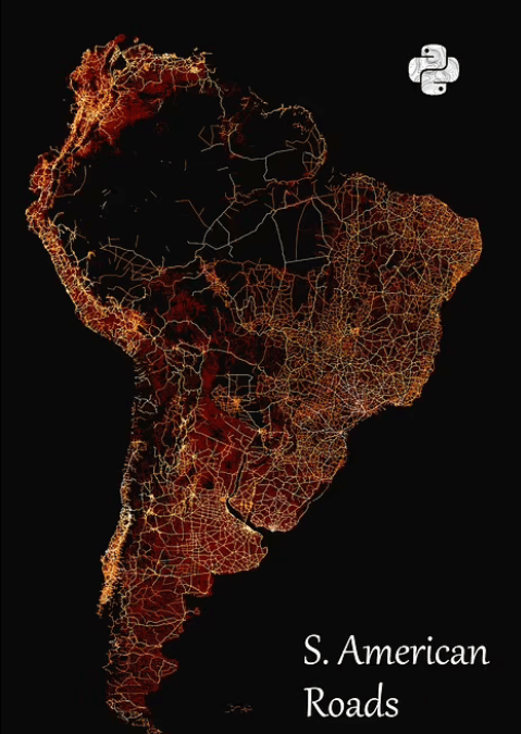
While in Africa and Australia, because of deserts and forests which are areas without roads, large patches have no color at all.

 of roads cover the whole world which range from big highways and motorways to countryside drives. To help you see how much land […]&media=https://wonderfulengineering.com/wp-content/uploads/2023/05/image-272.png)