Iceland’s recent volcanic eruption on the Reykjanes peninsula has garnered global attention, with NASA’s satellite imagery providing a stunning look at the destructive force of the eruption. Using infrared cameras aboard the NOAA-20 satellite, NASA captured before-and-after images showcasing the intense heat emanating from vast lava flows.
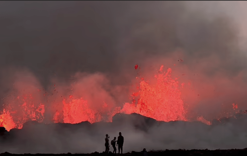
The eruption, which had been anticipated due to escalating seismic activity, was preceded by a swarm of earthquakes on December 18. A 2.5-mile-long fissure opened less than two miles north of the town of Grindavik, giving rise to five vents expelling hundreds of cubic meters of lava per second. At its peak, these vents emitted more than ten times the lava flow of Iceland’s last three volcanic eruptions.
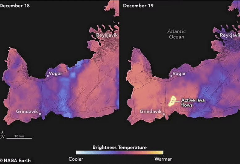
NASA’s satellite photos vividly capture the contrast between the cold, still landscape before the eruption and the radiating heat of the lava afterward. Simon Carn, a volcanologist at Michigan Technological University, explained that the bright areas in the images represent the high temperatures of the active lava flows compared to the surrounding terrain and clouds.
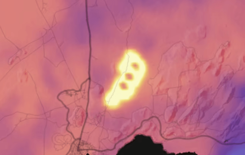
Examining the images closely, three circular areas at a lower temperature within the lava flow likely indicate hills around which the lava is streaming. The eruption’s violence and drama have also been recorded by other satellites, such as one operated by the European Organisation for the Exploitation of Meteorological Satellites, which captured the infrared flare of the eruption through dense cloud cover.
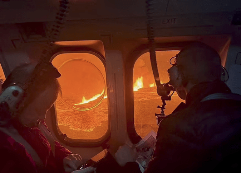
The current trajectory of the lava flow, according to NASA’s satellite data, is predominantly north and northeast, away from populated areas. However, concerns persist regarding potential southward movements, posing threats to Grindavik, the Svartsengi Geothermal Power Plant, and the Blue Lagoon tourist attraction. The consequences of lava reaching these areas could result in significant damage to homes and critical infrastructure.
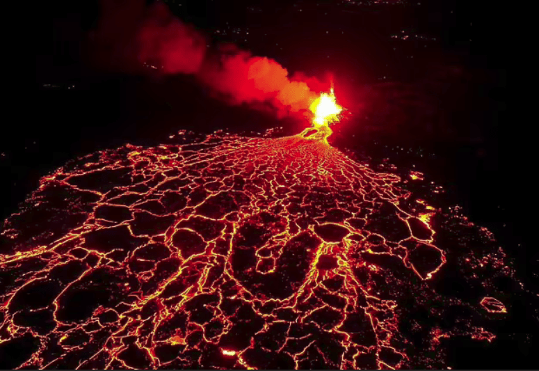
While the eruption seems to be slowing with only three vents currently active, experts caution that this does not necessarily indicate an imminent end. Iceland’s Met Office has warned of the increased likelihood of more vents opening, with potentially short warning times. Volcanologist Simon Carn emphasizes the possibility of the eruption becoming more dangerous if the lava accumulates, changes direction, or new fissures emerge.
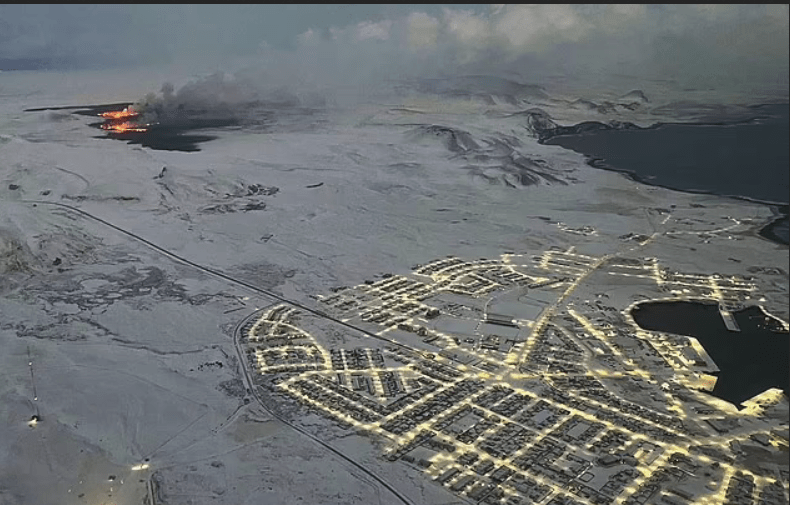
Despite the risks, some adventurous tourists have attempted to reach the volcano, prompting local authorities to emphasize the challenging journey and discourage inexperienced hikers. The Reykjanes peninsula remains closed to visitors, and residents of Grindavik have not been advised to return to their homes. As the situation unfolds, the potential for lava flow to impact crucial transportation routes and pollution spreading towards Reykjavík adds to the complexity and risks associated with this volcanic event.


