
Ever wonder what the internet looked like when it first started? Today, we are going to give you a picture of the earliest stages of the beautiful and probably the most revolutionary technology in human history.
David Newbury, who is a developer at the Art Tracks initiative in Pittsburgh’s Carnegie Museum of Art, stumbled upon an old map of the internet as it existed in May 1973 among several old papers.
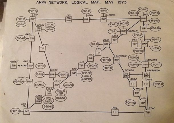
The map
The map entails many squares signifying nodes or gateways (first-generation routers). Hosts are represented by oval shapes, where were mainframe computers connected to the gateways. These included PDP-10, which was one of the most common computers appearing on the map repeatedly. Universities such as Stanford, UCLA, Utah and UCSB were present on the network.
Users were required to transfer data using ARPANET by dialling into a network, and by May 1973, the network expanded to 42 hosts connected to 36 nodes in Case Western, Carnegie Mellon, Harvard, and MIT.
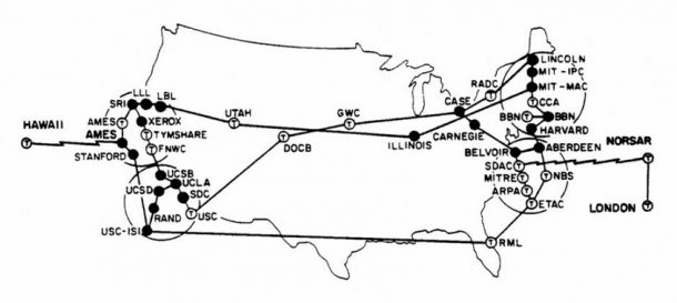
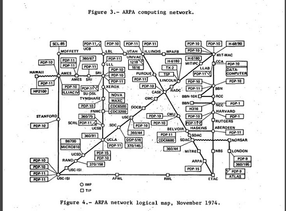
According to Netizens: On the History and Impact of Usenet and the Internet, in September 1973 a satellite link was used to connect ARPANET to nodes in Norway and London. This meant that daily over 2.9 million packets of information was sent, and the ARPANET was made international.
https://twitter.com/gadgetopia/status/807887068361879552?ref_src=twsrc%5Etfw
https://twitter.com/gadgetopia/status/807886901193621504?ref_src=twsrc%5Etfw
