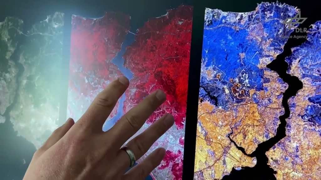
The German satellite “Enmap” is a cutting-edge technology to determine the trends in climate change conditions by assembling data from space. Recently, it has captured eye-catching images of a strip of the “Bosphorous strait” located in Istanbul, Turkey, as can be seen from space. It has been clearly depicted from the Space X Falcon 9 rocket of this German satellite that this strip is about 30 km wide and 180 km long, and it operates under the command of the “German Aerospace Centre”. If we see it from the perspective of efficiency in reaching its target terminal, then this Enmap satellite reached its destination within 8 days, i.e., on April 9, after the launch of the SpaceX rocket on April 1.
In the words of the project manager of Enmap, Sebastian Fisher, “The first data from EnMAP has demonstrated what the German environmental satellite is capable of.” But these first images already give us a very good idea of what researchers around the world can expect. They show that EnMAP can make a major contribution to highlighting the consequences of climate change and counteracting the ongoing destruction of the environment.”
The satellite has disclosed the images, which are produced in more than 250 color combinations by collecting the data from images and then reproducing the pictures in different colors. A key thing to remember is that relatively small wavelengths are used in the clustering of this data, which makes these colors invisible to the human eye. However, the thing that matters the most to the human eye is how these 250 colors combine to depict the geographical locations of the soil, water, and vegetation from the enormous regions in space, which ultimately gives us a piece of decisive information on the ecological problems. For this purpose, an exceptionally sophisticated hyperspectral instrument is employed by this Enmap satellite to collect the data precisely and in a reliable manner.
The use of these satellites in the collection of image data from space and then transmitting it to Earth is of crucial importance as it demonstrates the adverse effects of climate change on the Earth. Given this, Bradenburg’s Minister of Research said in an interview with CNN that “EnMap will provide reliable information about man-made changes and damage to our ecosystems in the future, and these are the best prerequisites for developing innovative measures to adapt to climate change.”

