
A vast underwater sinkhole in Mexico’s Chetumal Bay is forcing scientists to rethink what they know about so-called “blue holes.” Known as Taam ja’, the massive marine cavity appears to plunge far deeper than early measurements suggested, and researchers still have not confirmed where it ends.
New findings published in Frontiers in Marine Science show that the hole extends beyond 1,390 feet below sea level, with no bottom detected during recent expeditions, according to the study. Earlier sonar mapping had estimated a depth of roughly 900 feet, but sonar signals can be distorted in layered underwater environments where temperature and salinity shift dramatically.
To resolve the discrepancy, researchers deployed a CTD profiler, which measures conductivity, temperature, and depth using pressure readings rather than sound waves. Because pressure increases predictably with depth, this method provides more reliable measurements in complex underwater systems. During two trips in December 2023, scientists lowered the instrument on a 500-meter cable. On separate attempts, it recorded depths of about 1,365 feet and 1,390 feet, yet still failed to reach the bottom.
The cable length suggests the device may not have been traveling straight down. Currents inside the hole could push equipment sideways, and the structure itself may tilt, widen, or branch into chambers that are not directly beneath the surface opening. In other words, Taam ja’ may be far more structurally complex than a simple vertical shaft.
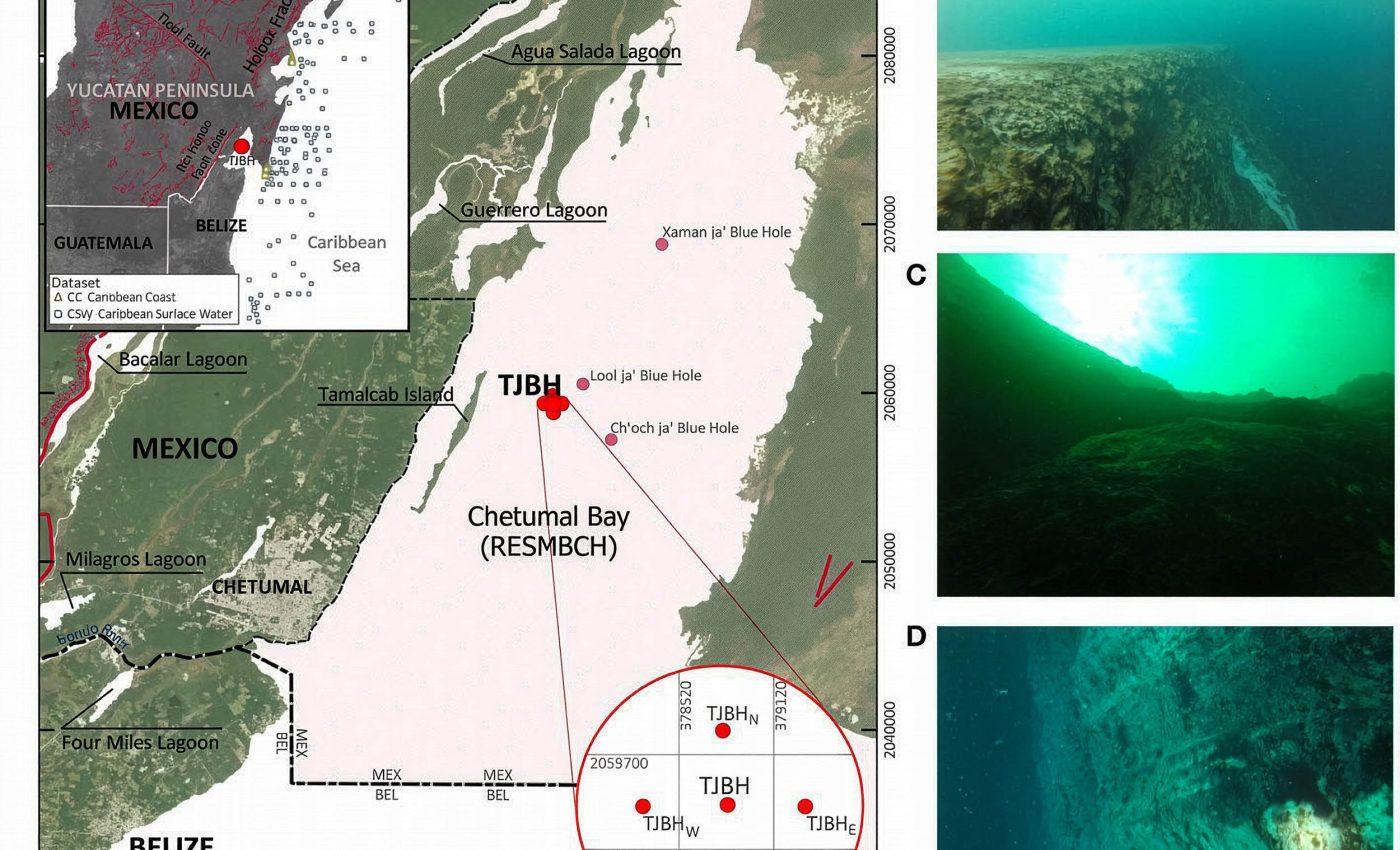
(A) Location of the Taam ja’ Blue Hole (TJBH) in Chetumal Bay, Mexico, is presented alongside the CC and CSW data regions for further comparison of water temperature and salinity conditions. Regional fracture zones and geological faults in the Yucatán Peninsula are indicated (INEGI, 2002), along with the locations of documented blue holes within Chetumal Bay. Credit: Frontiers in Marine Science.
Data collected during the descent also revealed sharply layered water inside the blue hole. The CTD recorded multiple pycnoclines, narrow zones where water density changes abruptly. These layers resist mixing, meaning water above and below can remain separated for long periods. Near the surface, conditions resembled the estuarine waters of the bay, with relatively warm temperatures and lower salinity. Deeper down, salinity increased significantly, and below roughly 1,300 feet, temperature began rising slightly again.
That pattern suggests the deepest water may originate from a different source, possibly linked to Caribbean marine systems rather than solely from the bay above. The Yucatán Peninsula’s limestone geology, shaped by dissolution and ancient sea-level shifts, makes such hidden connections plausible.
For now, Taam ja’ remains partially unexplored. Scientists can confirm it is deeper than 1,390 feet, but its true bottom remains unknown. Future missions aim to create a detailed 3D map and investigate chemical conditions and microbial life within its isolated layers.
