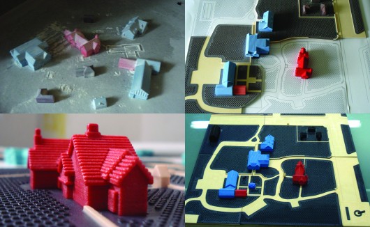
Traveling to unfamiliar places is quite difficult for us even with all our senses intact. But for those who can’t see where they are going, it is absolutely frightening. The latest piece of technology for these handicapped users is the new 3D mapping system that promises a brighter future. The technology is the courtesy of the combined effort by tactile-graphics company, Touch Graphics and the University of Buffalo’s Center for Inclusive Design and Environmental Access (IDeA Center). While it was designed specifically for the help of those who are visually-impaired, it also shows off the potential of tangible touch interfaces.
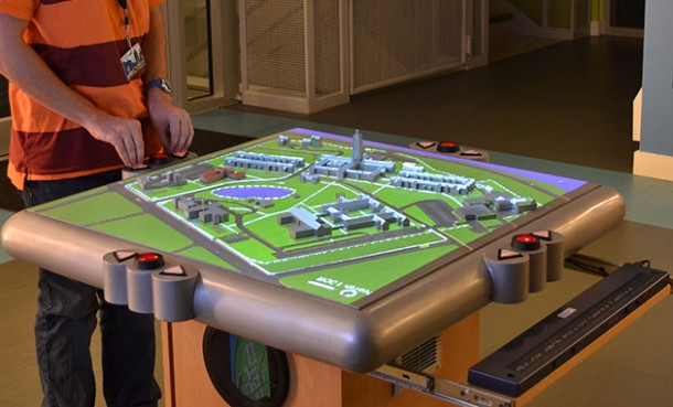
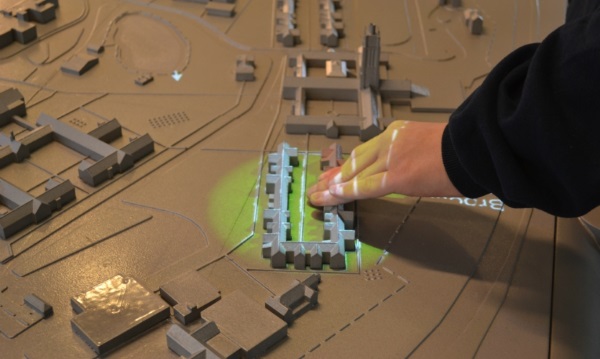
Currently this technology is being installed and deployed in three places. One is at Perkins School for the Blind in Massachusetts. When pressure of the visitor’s fingers is sensed through the conductive paint on the miniature buildings, signals are sent through thin wires to sensors housed in the pedestal. 
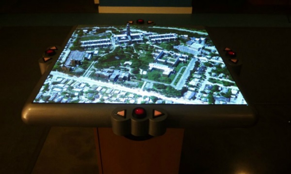
The name of the building is then announced by the computer and directions are offered as you interact with it, more information is added as you hold your finger in place. And for those with their visual sense intact, the name of the building and a spotlight from a video projector overhead illuminates it. This projector can be configured to project matching satellite imagery, visual effects and custom images.
The mapping system features sound effects like fountains gurgling and bells chiming, to help you move around the place. A three-button menu system helps the user to quickly grasp both the layout and names of places on map.
Future installment of the model set at the Overbrook School for the blind in Philadelphia is bound to get further improvements such as a video screen that illuminates the miniature buildings from below, while an earlier prototype of the system included a floor plan of the two-story Chicago Lighthouse for the Blind that swapped miniature buildings for raised lines and textures surfaces. Another prototype is also present at the Carroll Center for the Blind in Massachusetts.
The maps omit redundant information; designers focus on the details that are relevant for way-finding and orientation mainly. And the maps are oriented horizontally rather than vertically. This makes the navigation easier and experiencing the world is just the same for everyone.
For the blind people, this would be a huge deal. “The touch-responsive models solve the ‘last mile’ problem for blind pedestrians, who can often navigate to a building or campus address using GPS, but then need help to get to the classroom building or doctor’s office where they need to be”, Touch Graphics President Steve Landau explained.
The designers also say that these touch sensitive 3D talking maps might be just the beginning as the ‘Internet of Things’ rises on the back of tablet computing and 3D printing. “We may see sculptures, steering wheels, and exercise equipment controlled through touch and gesture,” they wrote. And flat- non tactile screens are becoming less common.
We believe that this technology will allow blind people to travel around without assistance so lets hope the developers make it commercial soon.


