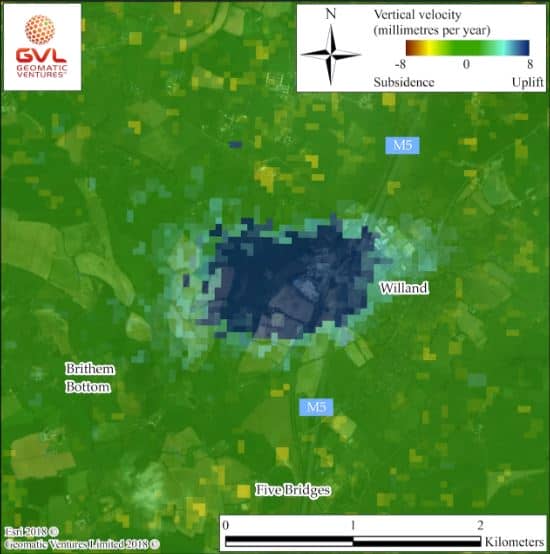
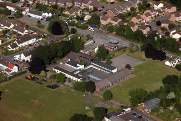
The residents of Willand, in Devon UK, are literally moving up in the world. The scientists have discovered that Willand is rising by 2cm each year and they do not know the reason behind this phenomenon. The elevation was discovered by researchers at Geomatic Ventures Limited (GVL). It is an offshoot company of the University of Nottingham and has been working on the first country-wide map of the land movement of Britain.

While analyzing the images from 2015 to 2017, they noticed that an area around 1.2-miles wide was rising steadily by almost 2cm per year. This phenomenon usually occurs in the abandoned mines, however, there is no such thing in Willand. Dr. Andy Sowter, Chief Technical Officer at GVL, said, “We generally see this sort of uplift where there have been mining works and the pumps have been switched off, allowing the water to gradually seep back into the ground. But I contacted the British Geological Society to ask if there was any history of mining in the area and there is none. Willand is in the middle of nowhere, and there were no mines, so we have no idea what is going on.”

According to experts, as both the urban areas and the surrounding fields are rising, it suggests that the reason for this lies deep underground. They have expressed the concern that this can be because of a huge leak or environmental discharge. Dr. Sowter further said, “It’s fairly sizable, the whole town is moving here. I think the authorities definitely need to go down there and investigate what is going on. If it is down to liquid seeping underground, or some sort of discharge of waste then that could be a threat to the environment. If this is not a natural occurrence then it is symptomatic of something happening underground so it’s important to find out what that is.”

Willand villagers have not noticed the changes since the whole area is rising at the same rate. The structural damage is also not expected to occur, but the scientists are concerned about the effects that this might have on the high-speed rail passing through the area as well as on the M5 motorway as well. Dr. Andy Sowter said, “We’ve spoken to the Environment Agency and the British Geological Survey, and right now we can’t explain it. We don’t know why it’s going up.”
Do you have a logical reason to explain this? let us know in the comments section!


It’s obvious behind willand there is a massive landfill called broad path. It should have beenough called deep path it was two big sandpits which were pumped out for years as it hit a depth of 108 meters then in 1998 so bright some spark decided to fill it with domestic and industrial waste. The river is full of leachate and the environment agency areally covering it up .